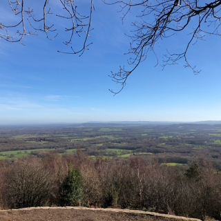


The Blackdown Hills are on the Surrey and West Sussex border on the outskirts of Haslemere. If you follow the What3Words directions they will take you to a couple of very handy free car parks right on the top of the hill, from where there are easy flat(ish) paths all over the top of the hills. Due to the height and fine sandy ground most surface water drains away leaving numerous dry and clean paths to walk on.
Even if you don’t follow our tracks, there are footpaths galore, and if you go on a clear day the views are simply stunning. You can see for miles and miles from various viewpoints, even so far as the Solent and English Channel. Benches abound for the odd break from your walk, and there are bronze distance markers that tell you what you are looking at and how far away it all is. The area is run by the National Trust so you can be sure it’s well looked after and there are plenty of signposts, but do make sure you know where you parked and how to get back as it’s quite easy to lose your bearings.
Our walk is just over 4.5 miles, taking just under 9,500 steps and burning nearly 500 calories. But it’s quite strenuous in parts as we chose to walk down the hill, and what goes down must come back up. If you don’t like walking up and down hills (which are quite steep at points), there are plenty of flat, dry paths all over the top of the hills, so you don’t have to be over energetic, and there’s still plenty to explore.
